


Contact Info
Gifford Pinchot National Forest
2455 Hwy. 141
Trout Lake, WA 98650
2455 Hwy. 141
Trout Lake, WA 98650
- Phone:
- 509-395-3400
Basics
- Length:
- 3.5 miles (5.6 km)
- Difficulty:
- Intermediate
- Elevation Range:
- 4100 feet to 4200 feet
- Elevation Change:
- 100 feet
- Usage:
- Heavy
- Season:
- Mid-July to October
Description
This heavily used trail begins on Road 420 on the northwest side of Indian Heaven Wilderness. It travels southeast through large timber. Just before Placid Lake (4,042 feet elevation), the trail enters the wilderness and continues for 0.5 mile before intersecting with the Chenamus Lake Trail No. 29A. Placid Lake Trail continues up the west slopes of Bird Mountain to a high meadow, where it ends on the Pacific Crest Trail.
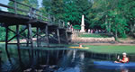
Placid Lake, meadows, wildflowers, and a small lake.
Details
Length:
3.5 miles (5.6 km)
Difficulty:
Intermediate
Elevation Range:
4100 feet to 4200
Elevation Change:
100
Usage:
Heavy
Season:
Mid-July to October
Map + Directions
Basic Directions
Road 3000420 or Trail #2000
Placid Lake - Trailhead is on south side of FR 3000420. Placid Lake trail no 29 leads south and east into Indian Heaven Wilderness.

