


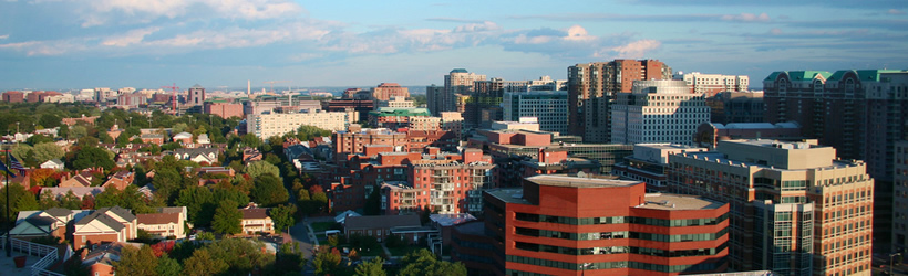
Transportation information for Arlington County is provided below. Travel information includes driving directions, maps, airport information and more.
Transportation Services
aally taxi
- sterling
- Transportation Services
- 571-335-7177
Silverline Sedan & Limo
- Herndon
- Transportation Services
- 703-968-0573
20% OFF IAD-DCA-BWI AIROPORTS TAXI
- Sterling
- Transportation Services
- 571-379-6888
Charter Bus R Us, Inc
- Falls Church
- Transportation Services
- 703-829-0660
travelers taxi & shuttle service
- Stafford
- Transportation Services
- 540-408-4071
Mats Taxi & Car Svc
- Falls Church
- Transportation Services
- 703-534-6287
Gq Sedans & Limo Services
- Gaithersburg
- Transportation Services
- 888-765-7332
Alpha Limo Service
- Springfield
- Transportation Services
- 703-339-4547
Affordable cab
- Woodbridge
- Transportation Services
- 571-331-3642
Transportation General
- Arlington
- Transportation Services
- 703-525-0900
Dulles Airport Taxi & Limousine LLC
- Herndon
- Transportation Services
- 703-629-8899
Limo Network Natinwide
- Springfield
- Transportation Services
- 202-999-5400
Waldorf Taxi & Airport Transportation
- Waldorf
- Transportation Services
- 240-389-8363
World Sedan, Inc
- Vienna
- Transportation Services
- 202-241-4000
Checkered Flag Taxi Cab Service
- Stafford
- Transportation Services
- 540-288-8200
Virginia Railway Express Headquarters
- Alexandria
- Transportation Services
- 703-684-1001
Montano's Transportation
- Herndon
- Transportation Services
- 571-203-0300
Dulles Air Port Taxi & Limo
- Sterling
- Transportation Services
- 703-629-8899
American Dulles Cab
- Chantilly
- Transportation Services
- 703-470-7329
Dulles Priority Cab
- Reston
- Transportation Services
- 703-489-4144
Ontheway taxicab & shuttle service
- silver spring
- Transportation Services
- 240-600-4419
CHANTILLY YELLOW CAB
- Chantilly
- Transportation Services
- 703-334-8294
Sky Transportation Group
- Falls Church
- Transportation Services
- 202-438-4816
Bmlimousine
- Falls Church
- Transportation Services
- 202-468-8796
Waldorf Cab
- Waldorf
- Transportation Services
- 240-299-5490
BT Shuttle
- Silver Spring
- Transportation Services
- 301-244-8005
TriState Cab Service
- Sterling
- Transportation Services
- 703-732-3335
Royal Express Limo & Cab
- Herndon
- Transportation Services
- 703-269-8640
Togotaxi.Co
- Gaithersburg
- Transportation Services
- 866-611-0609
Z Shuttle Inc
- Herndon
- Transportation Services
- 703-793-9500
Alexandria Yellow Cab
- Alexandria
- Transportation Services
- 703-549-2500
Bluebird Cab Co
- Lanham
- Transportation Services
- 301-864-7700
AdMerk.mobi
- Fairfax
- Transportation Services
- 703-763-4408
Dts
- Falls Church
- Transportation Services
- 703-237-3671
Metro Finest Limousine
- Waldorf
- Transportation Services
- 888-958-5950
Bates Tours & Charter Service Inc.
- Woodbridge
- Transportation Services
- 866-451-5778
National Luxury Car Service
- Fort Washington
- Transportation Services
- 301-974-5959
L W Transportation
- Chantilly
- Transportation Services
- 703-955-7801
Limo Runs
- Washington
- Transportation Services
- 202-831-4600
Jab Limo
- Springfield
- Transportation Services
- 703-627-8414
Omniride/Omnilink
- Woodbridge
- Transportation Services
- 571-348-0493
Maxi Sedan & Limousine Service
- Falls Church
- Transportation Services
- 703-524-4444
Transportation Centers Inc
- Vienna
- Transportation Services
- 703-573-0900
Trans-Assure
- Fairfax
- Transportation Services
- 703-273-8890
Essence Entertainment Group
- Arlington
- Transportation Services
- 703-861-0982
Reliable Transport
- Alexandria
- Transportation Services
- 240-330-3131
Dc metropolitan Limousine
- Falls Church
- Transportation Services
- 202-664-7720
Stanley Business Co Inc
- Marbury
- Transportation Services
- 301-684-2251
M V Transportation
- Falls Church
- Transportation Services
- 202-204-4557
Boverxs Limousine Svc Inc
- Alexandria
- Transportation Services
- 703-953-1200
Airports
The nearest major airports are the Washington National Airport located 4 miles from downtown Washington D.C. or the Baltimore-Washington International airport located approximately 40 miles north of Arlington, just south of Baltimore, MD. Both airports all are serviced by all major airlines to destinations all over the nation as well as International destinations.
Ronald Reagan Washington National Airport
- 3 miles S from Washington
- DCA
- Public
- 703-417-8050
Map + Directions
Basic Directions
Arlington County is located in Northern Virginia, less than five miles from Washington, D.C. across the Potomac River between I-66 and I-495.

